
For our last full day in Acadia we had to take in the famous “Bubbles”. We therefore caught the bus from the visitor centre at Hull’s Cove to Jordan Pond house.
Part One:
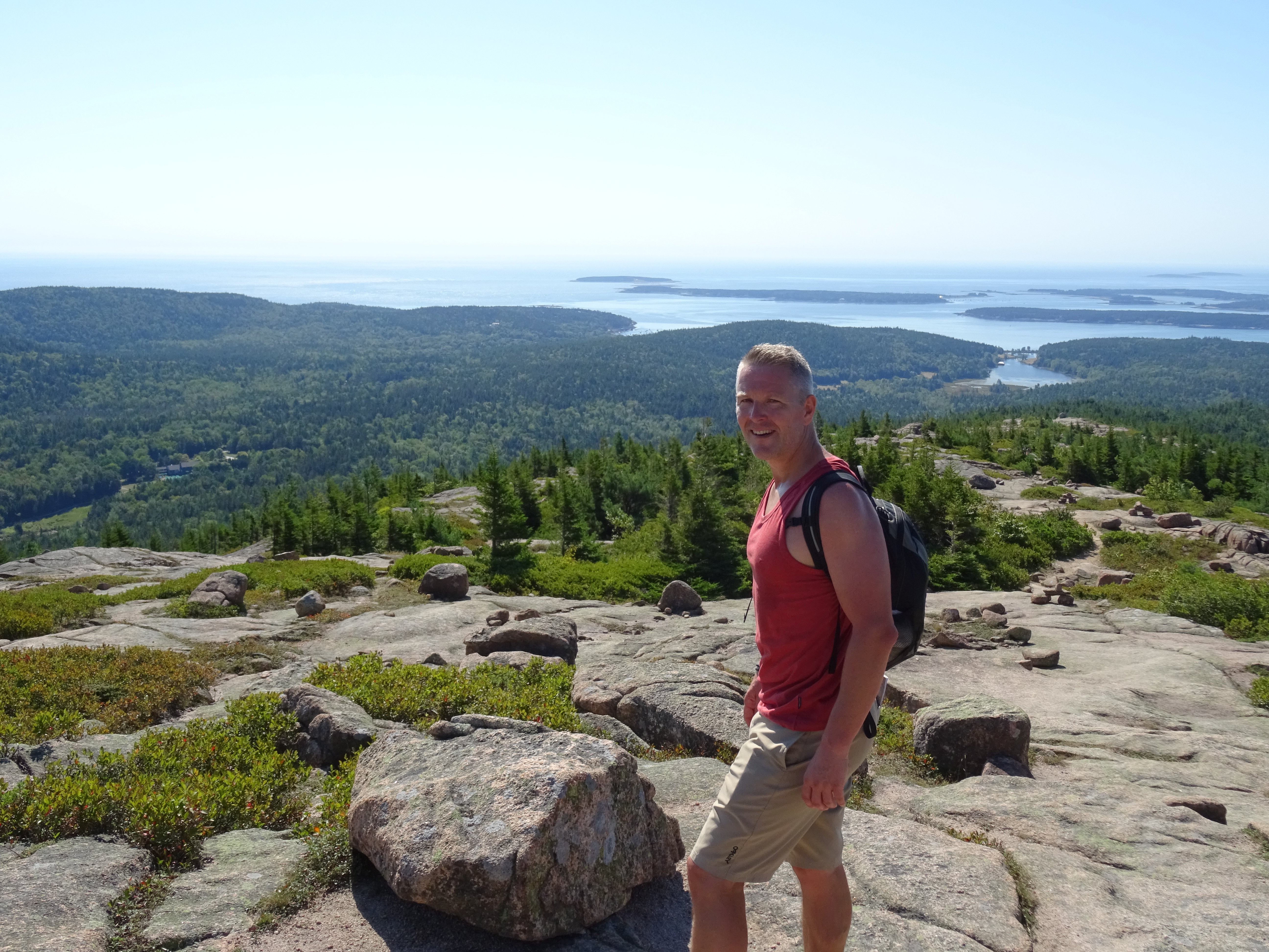
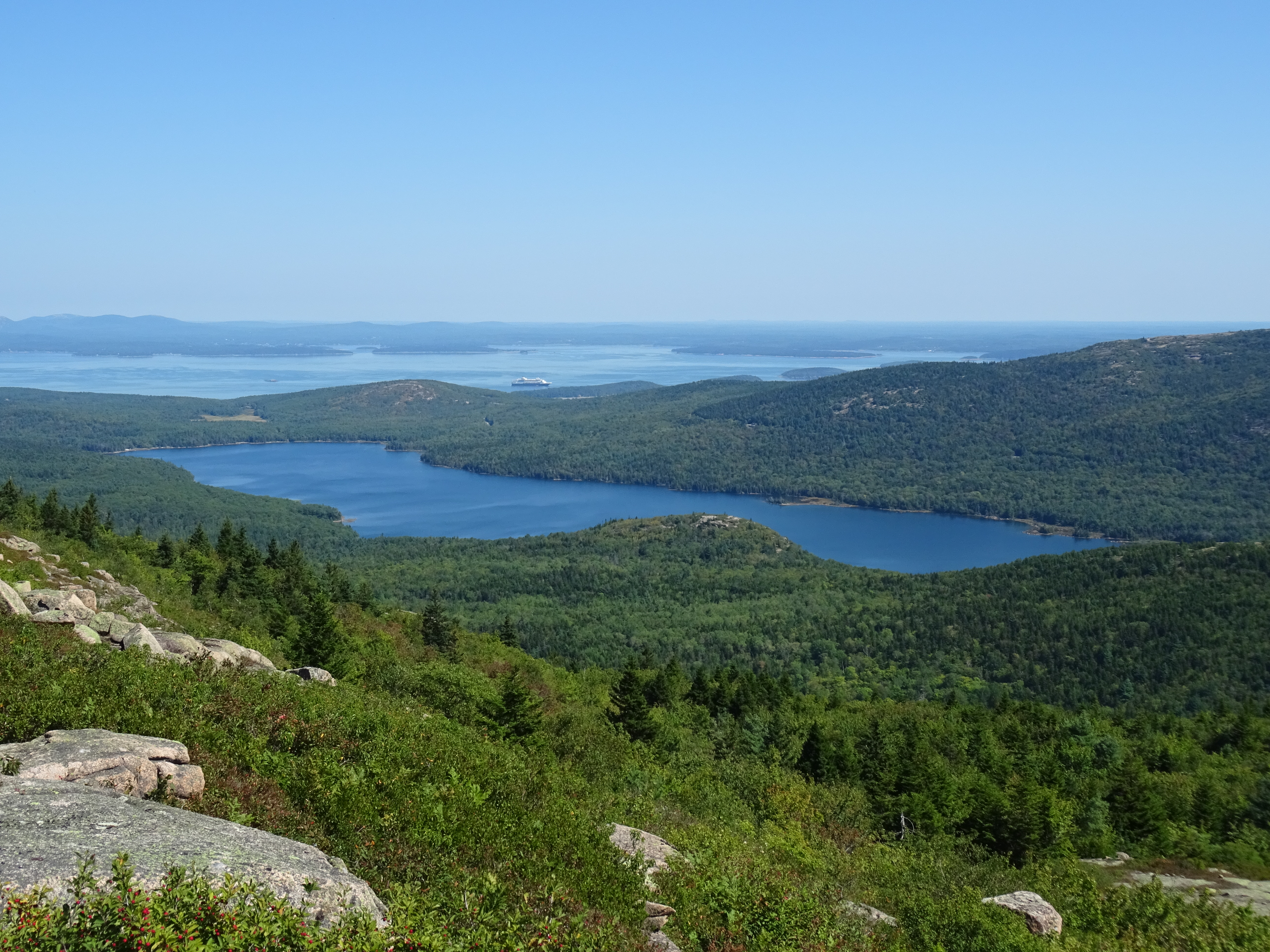
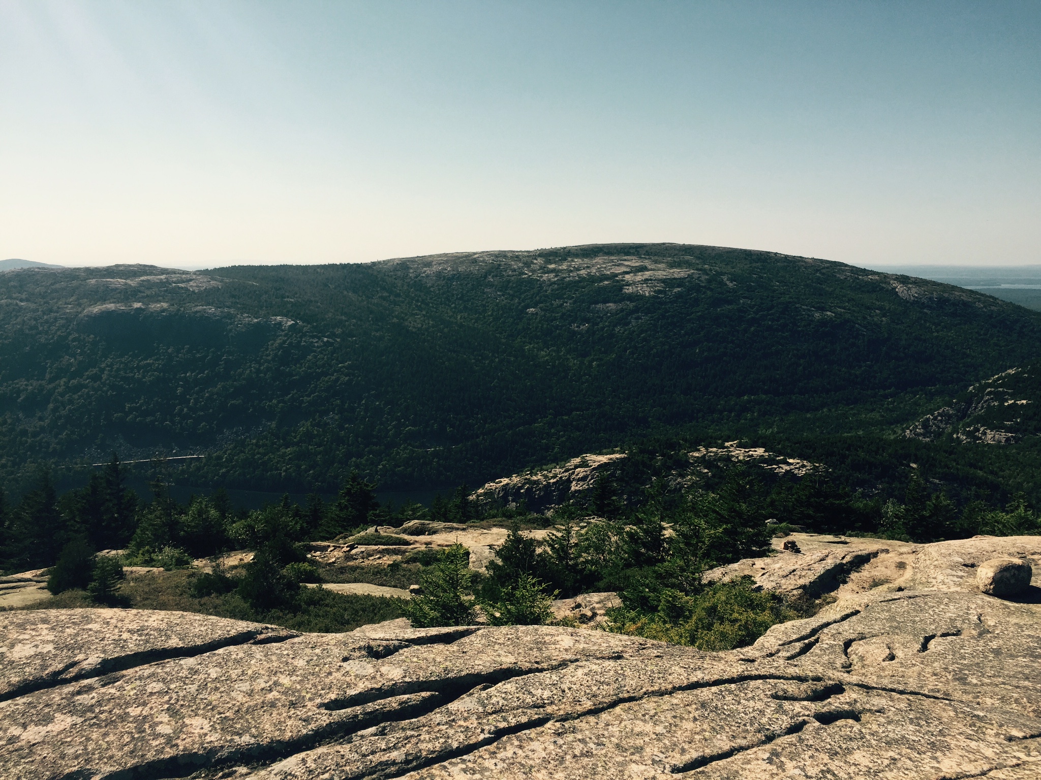
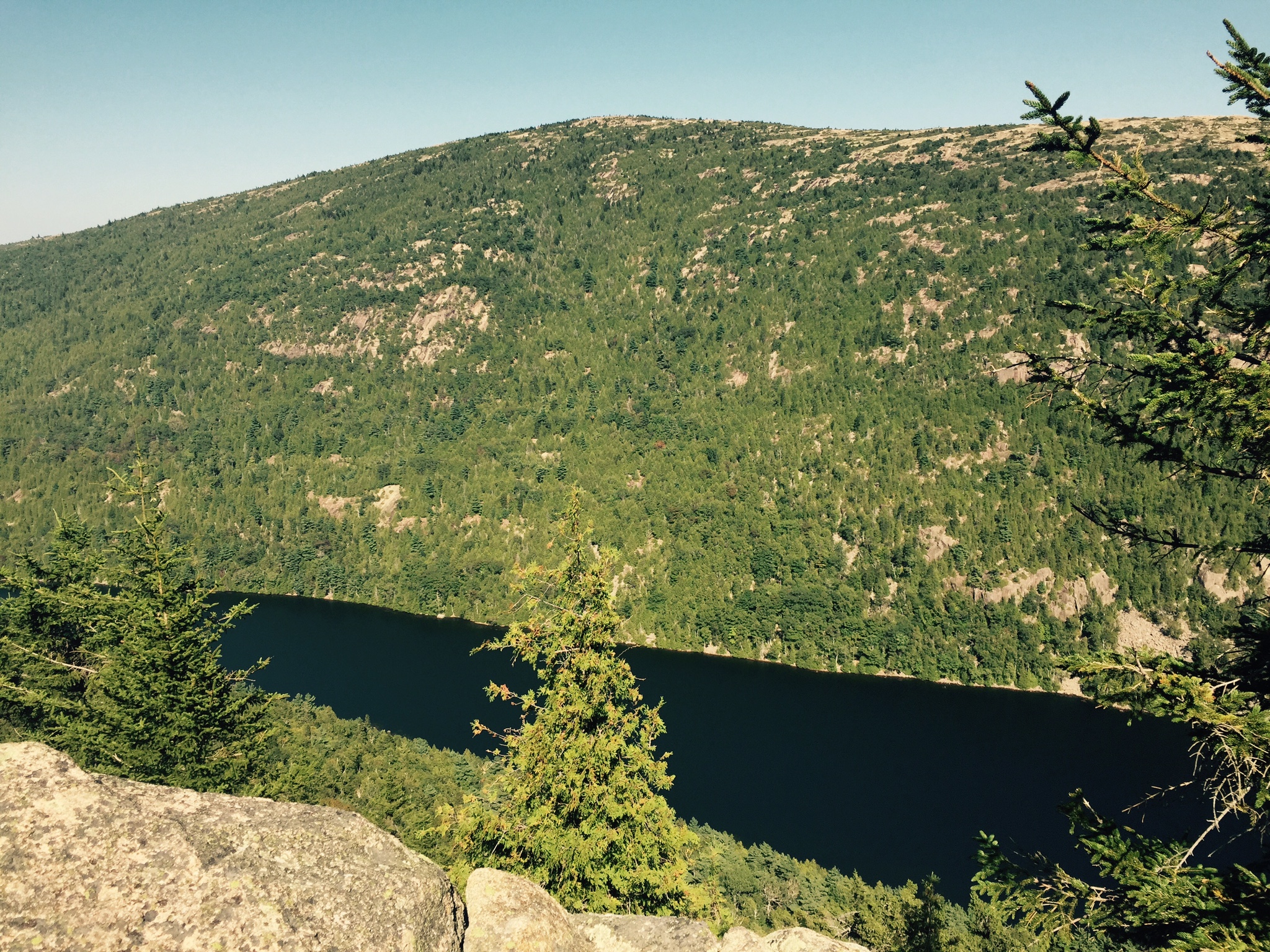
We started off first by taking in the fifth highest mountain in Acadia – Penobscot. It’s an impressive looking mountain with exposed cliffs on the western side of Jordan Pond and opposite Pemetic.
Our chosen path from the bus stop was up the strenuous Spring trail. We started off by crossing the footbridge over Jordan stream and then headed into the woods. After crossing the carriage road, the trail headed up the steep rocks. The path zig zags its way up through narrow and sometimes tight gaps, climbs with iron handrails and along some “exposed” sections right on the edge which were fortunately protected by wooden log handrails.
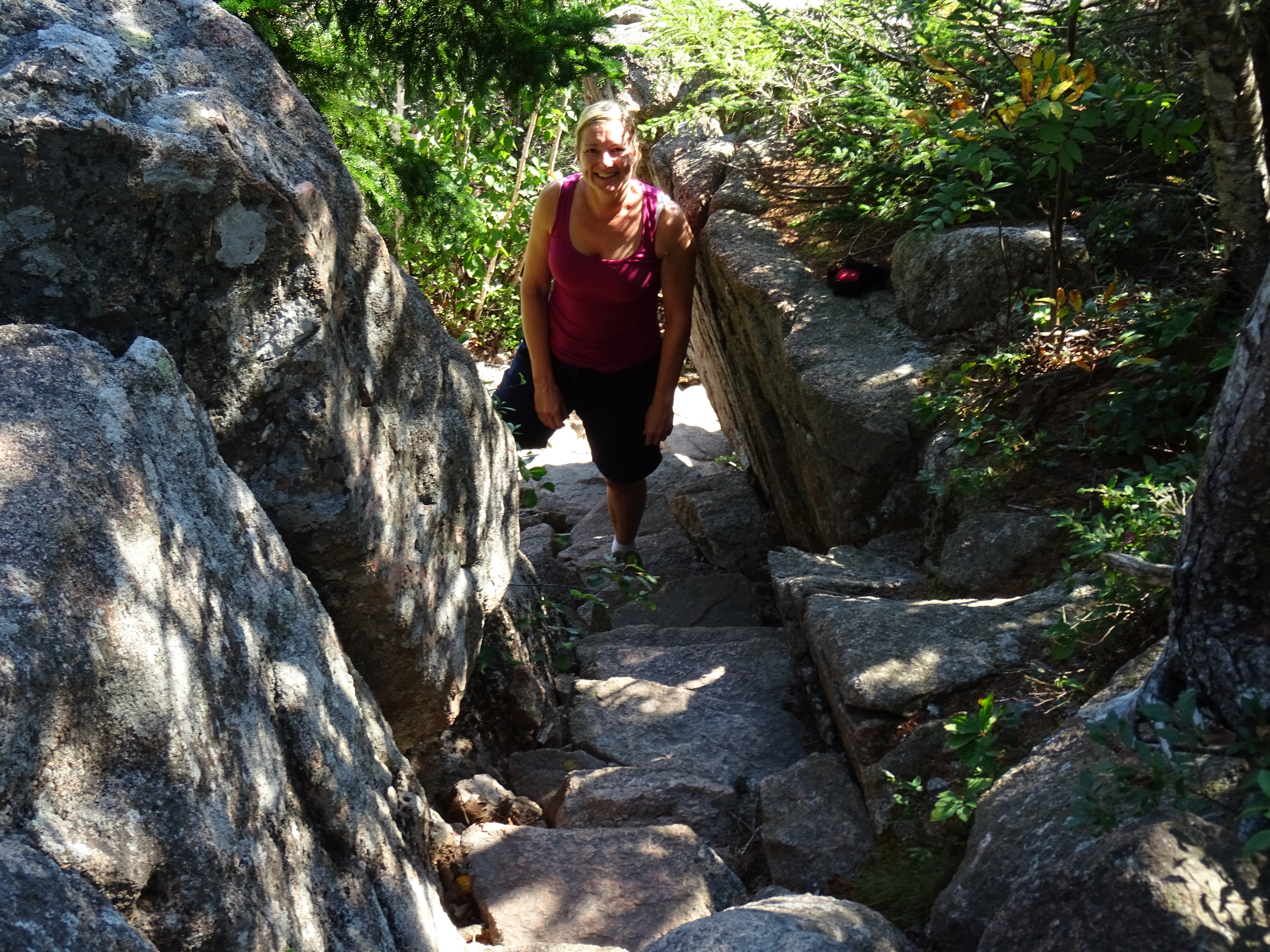
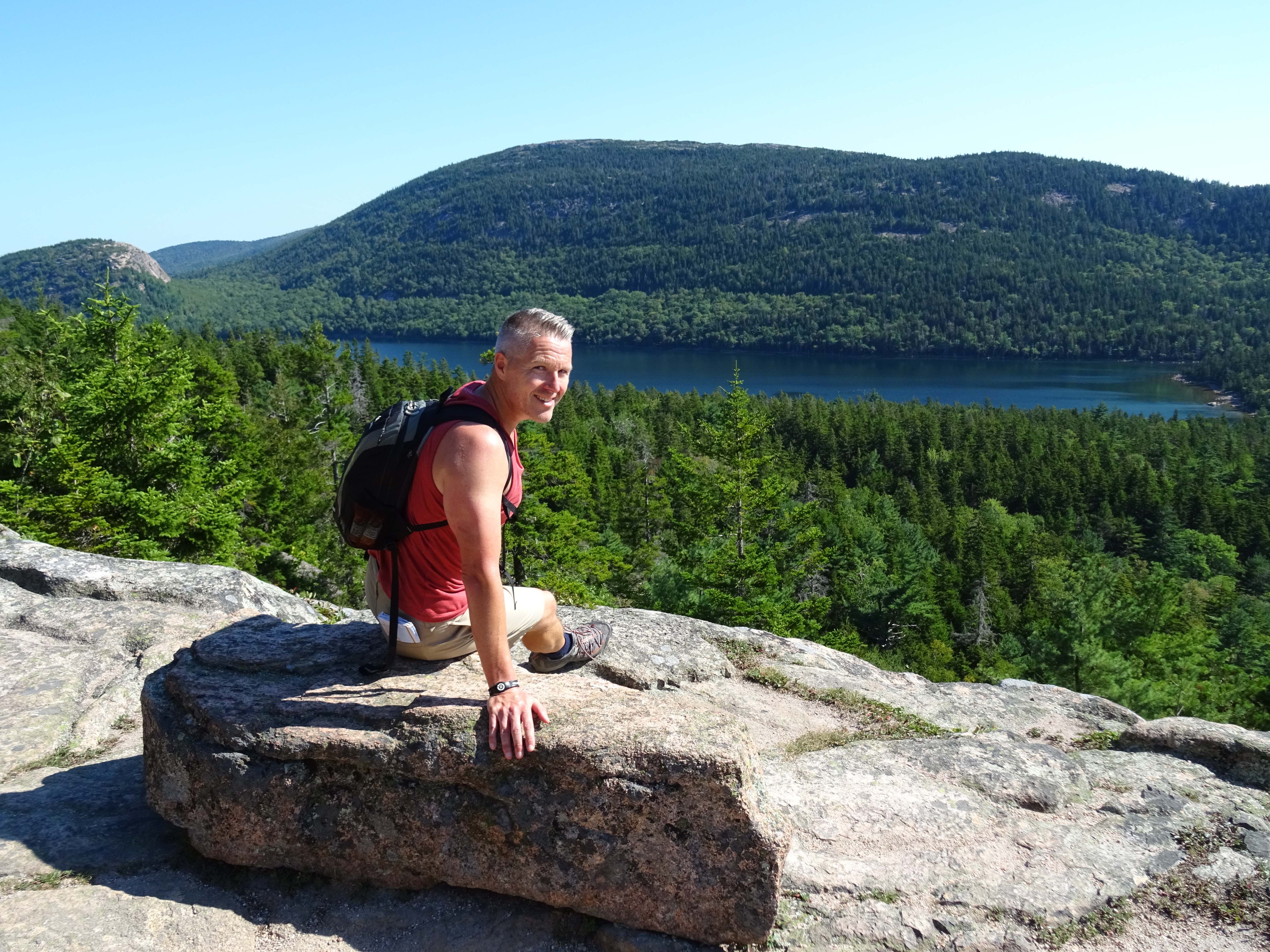
The weather was again glorious so the climb was hard work in places but exhilarating. When we emerged from the trees, we were welcomed by a particularly nice viewing point overlooking Jordan Pond. After taking a few moments to admire the views, we headed off…. unknowingly…. in the wrong direction! It wasn’t long before we soon realised that we weren’t on the right path as it came to a dead end (I’m pretty sure we’re not the only ones to have done this!). We double backed on ourselves to where we had stopped and then saw the path to the left (and not to the right – the dead end!).
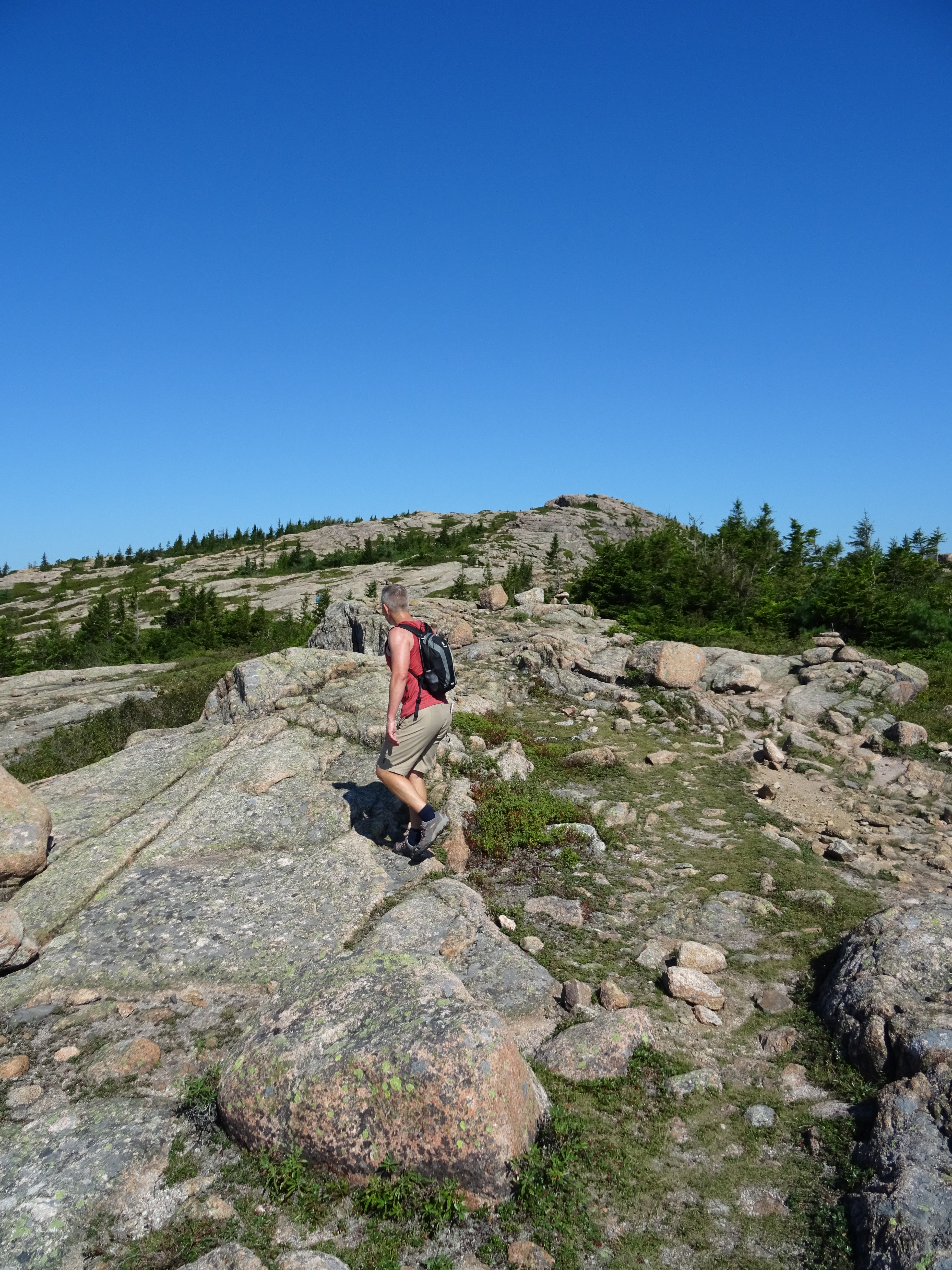
After a short climb, we left the treeline behind. The path opened up over the open mountain face. The views all around us were spectacular. Cairns (American style) lined the way to the top – not that we needed them as it’s clear in which direction you are heading.
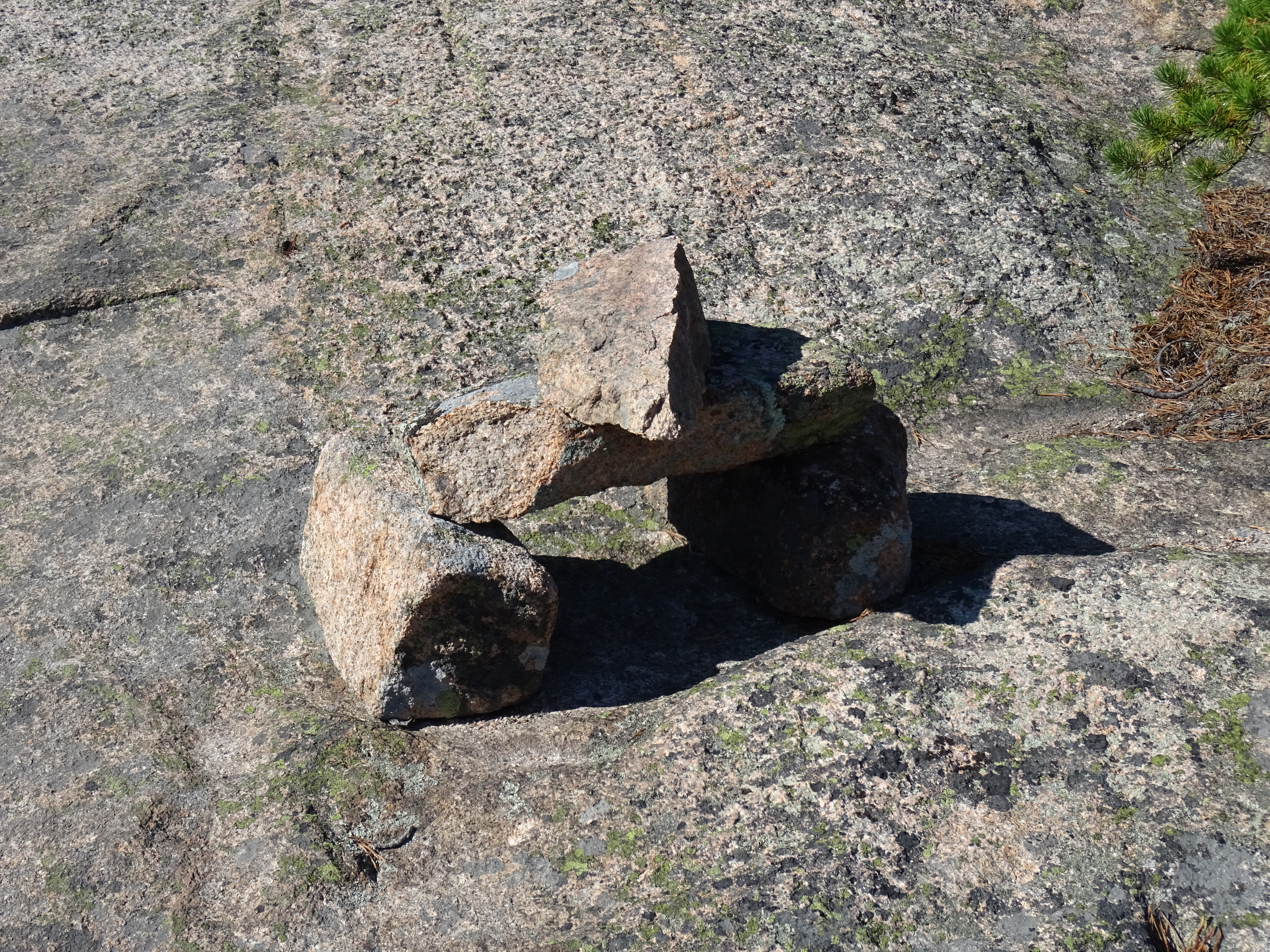
There were some unusual granite rock formations created by the mighty glaciers along the way which called for several photo opportunities.

It’s easy to see why this walk is so popular (we did see several people) as it’s not too strenuous especially after the initial first climb. I’m sure some of the other trails would also cut out the tough climbs on the Spring trail making it even easier.
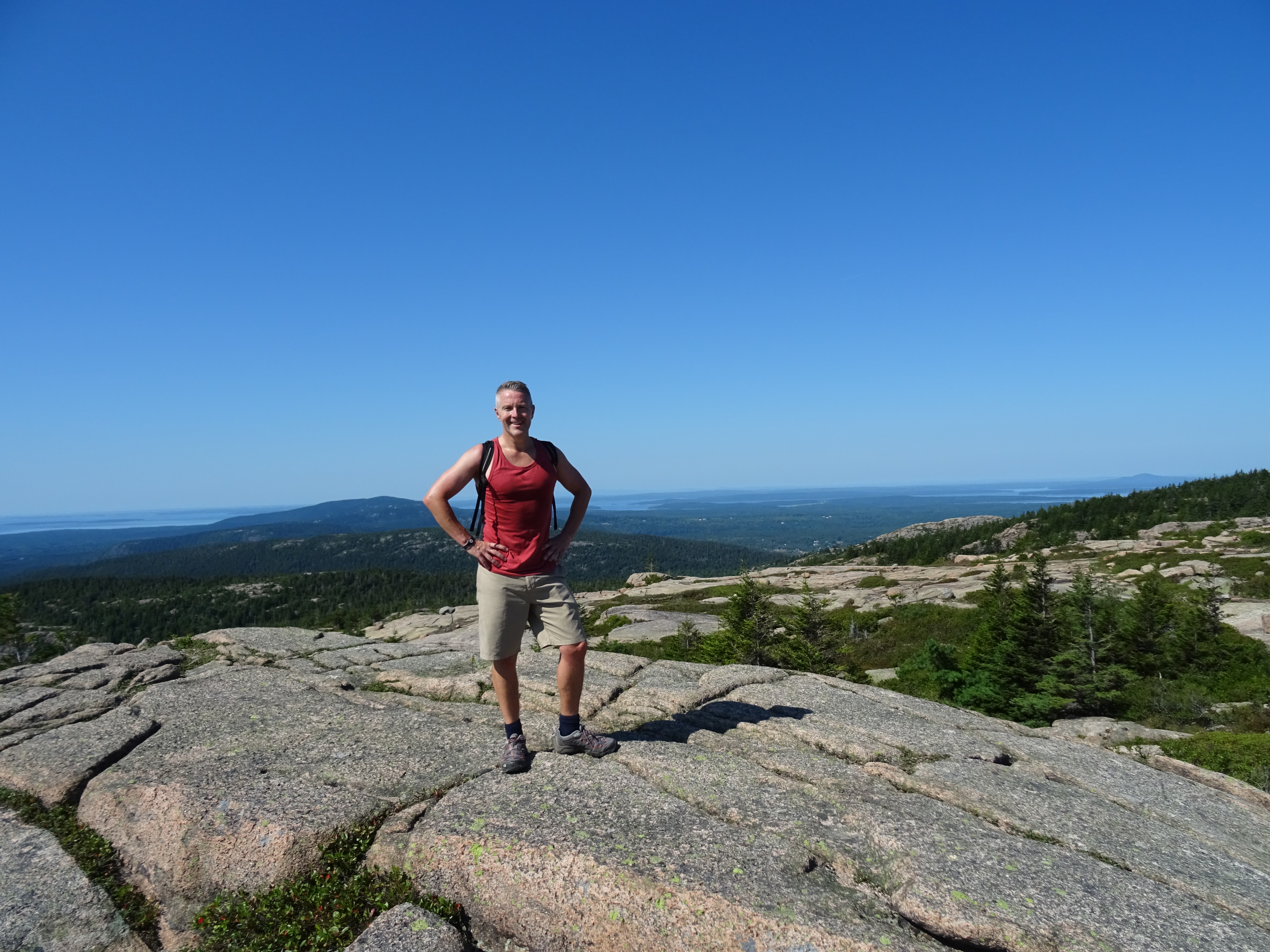
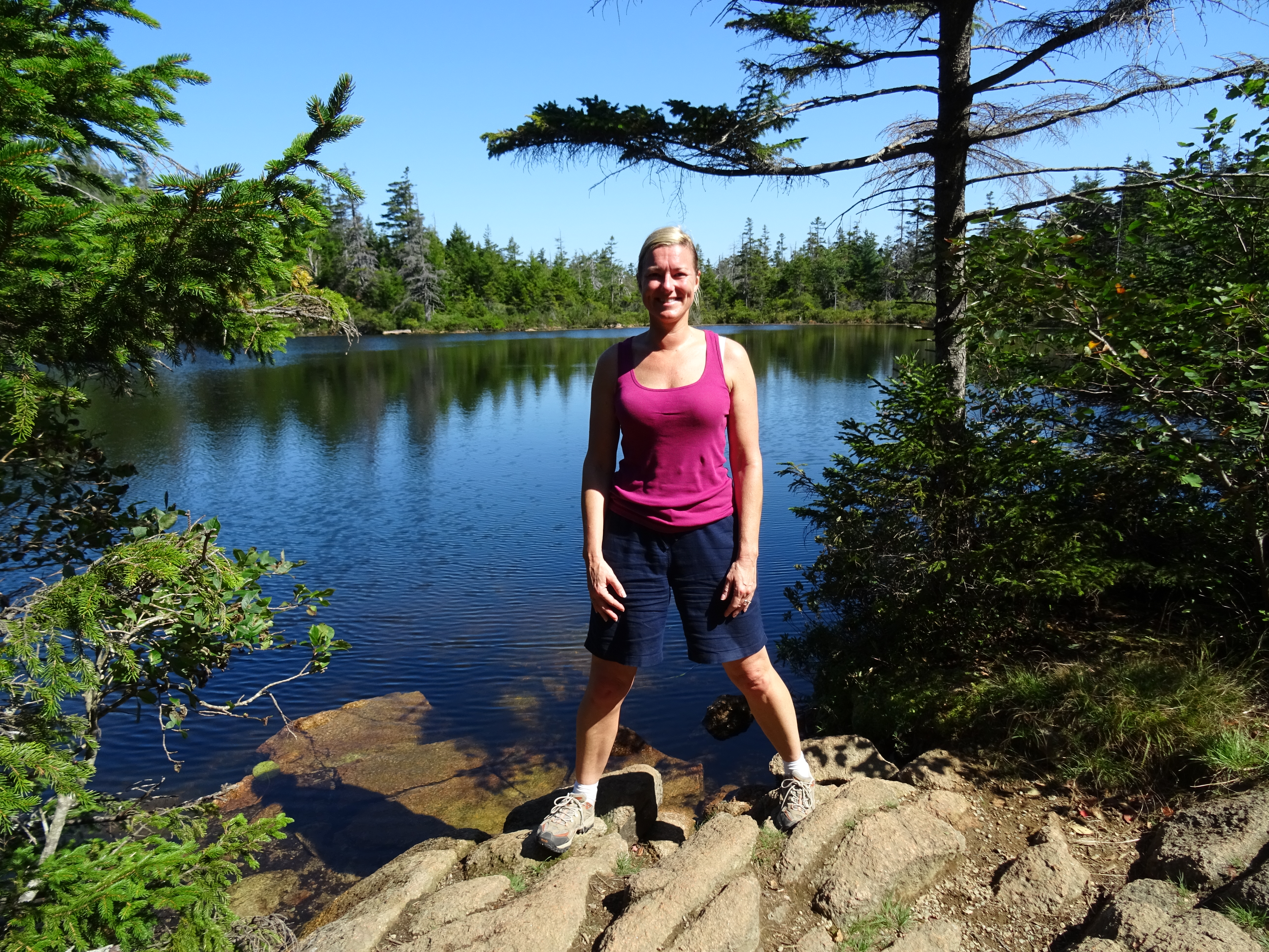
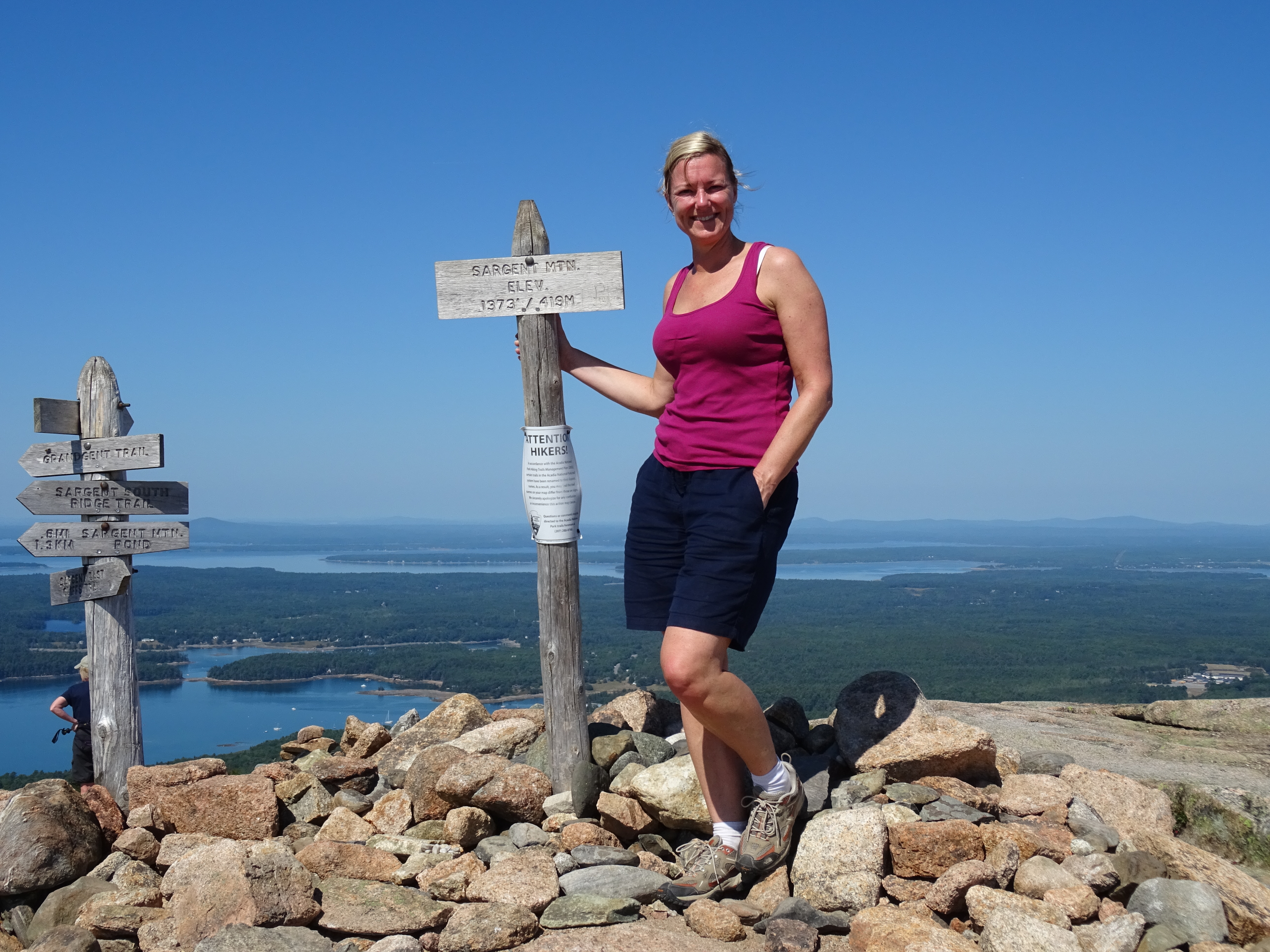
From the summit, the next peak could easily be seen – Sargent Mountain (at 1373 feet, Sargent is the second highest in Acadia). It’s only about a mile away so we headed over by dropping down into a small forested area passing Sargent Pond on the way.
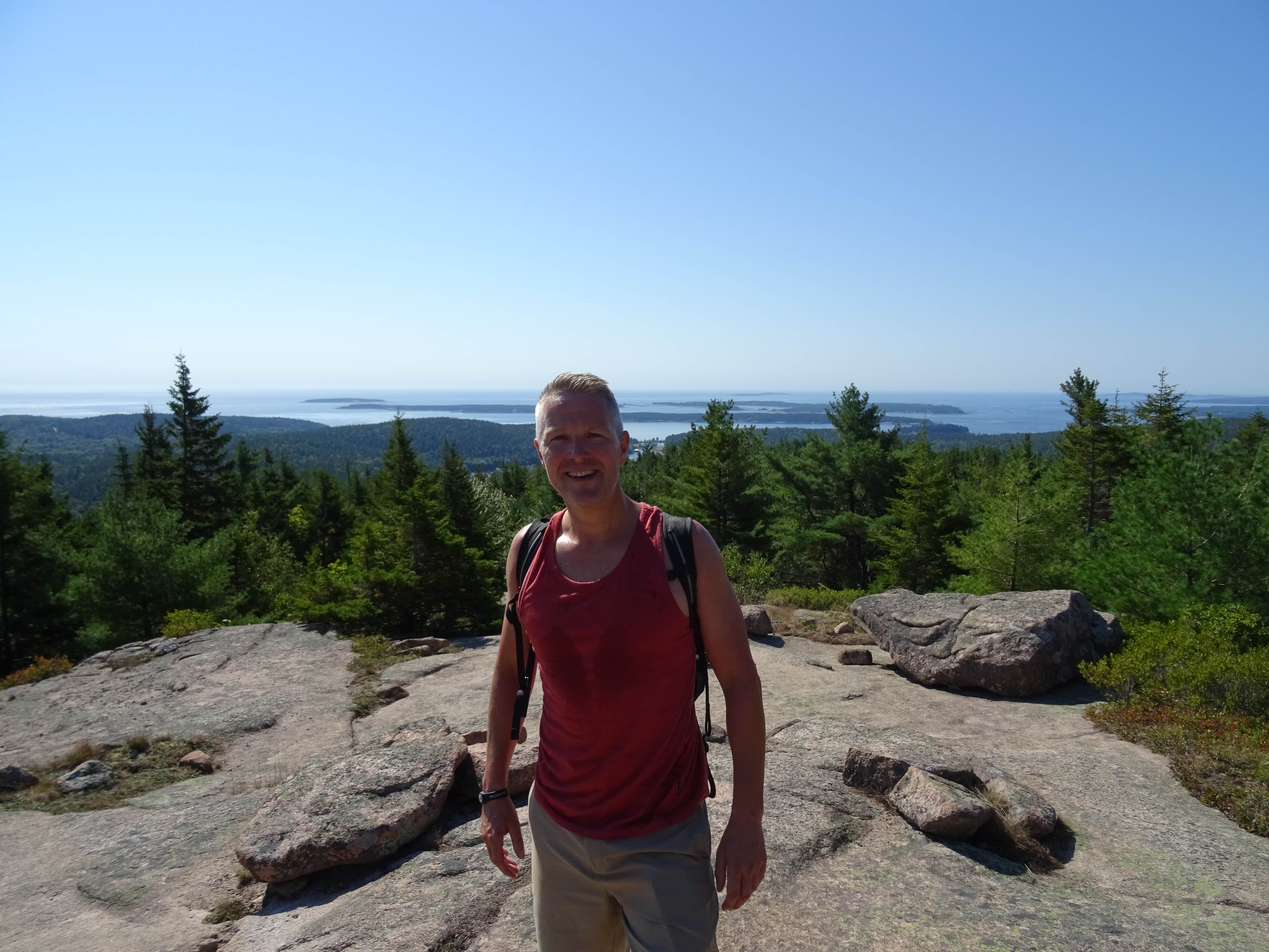
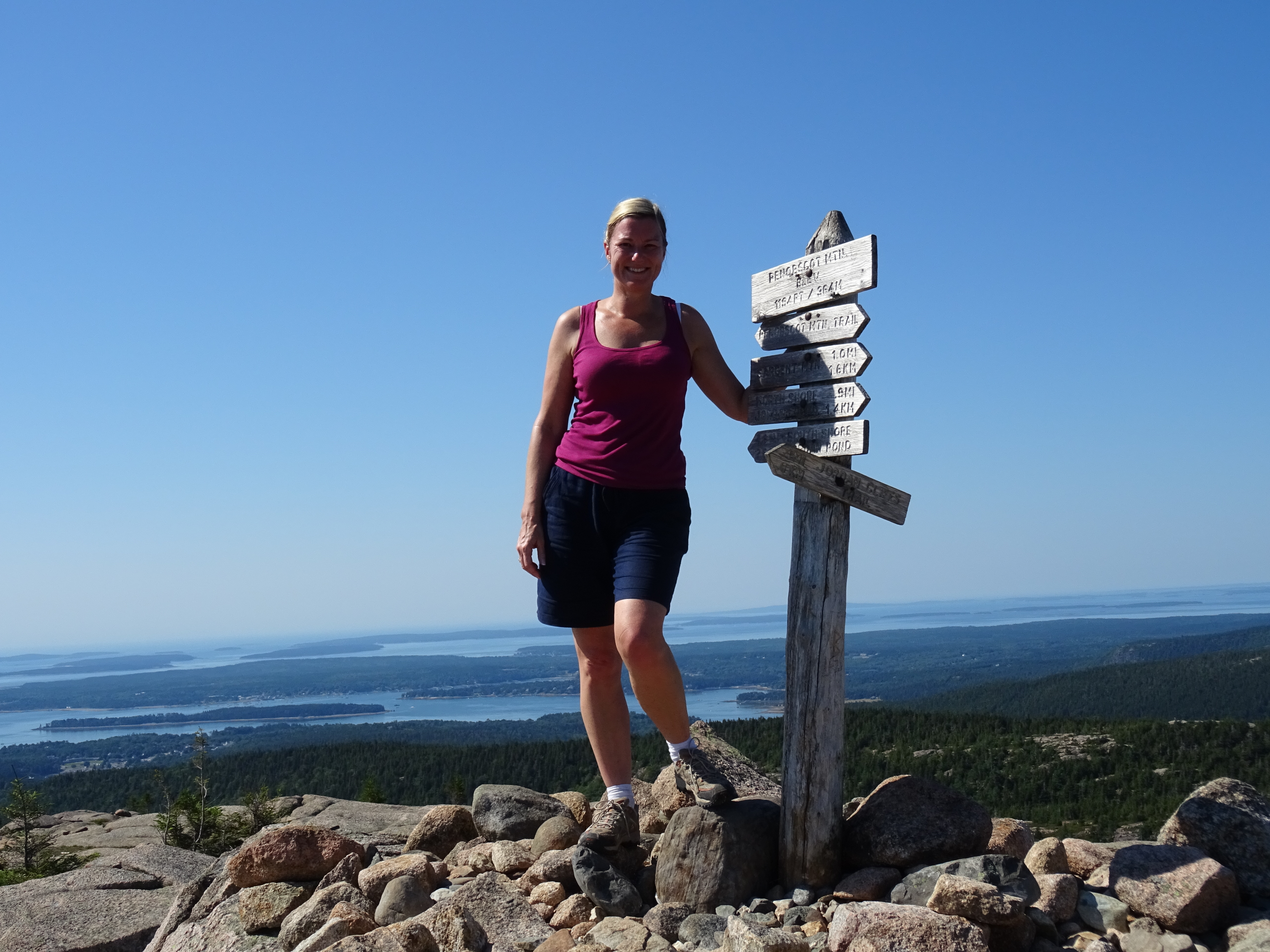
From Sargent Pond, the path climbed steeply to join the Sargent South West trail. Once out of the trees, we began the climb towards the summit. The ground was covered more in plants and vegetation unlike the other mountains that we would soon discover and hike in Acadia. We eventually reached the summit which was marked with a wooden sign like all other summits in Acadia.
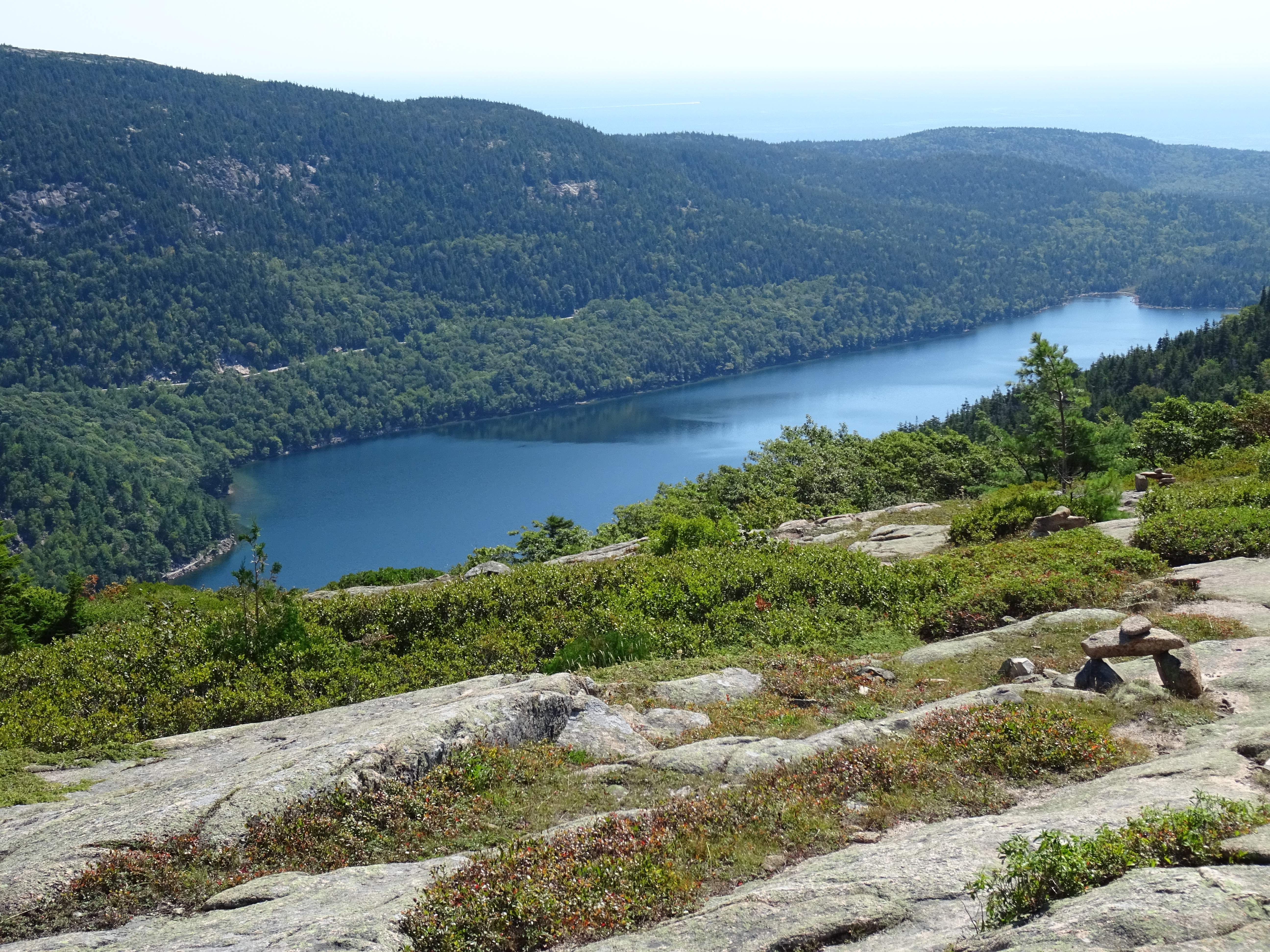
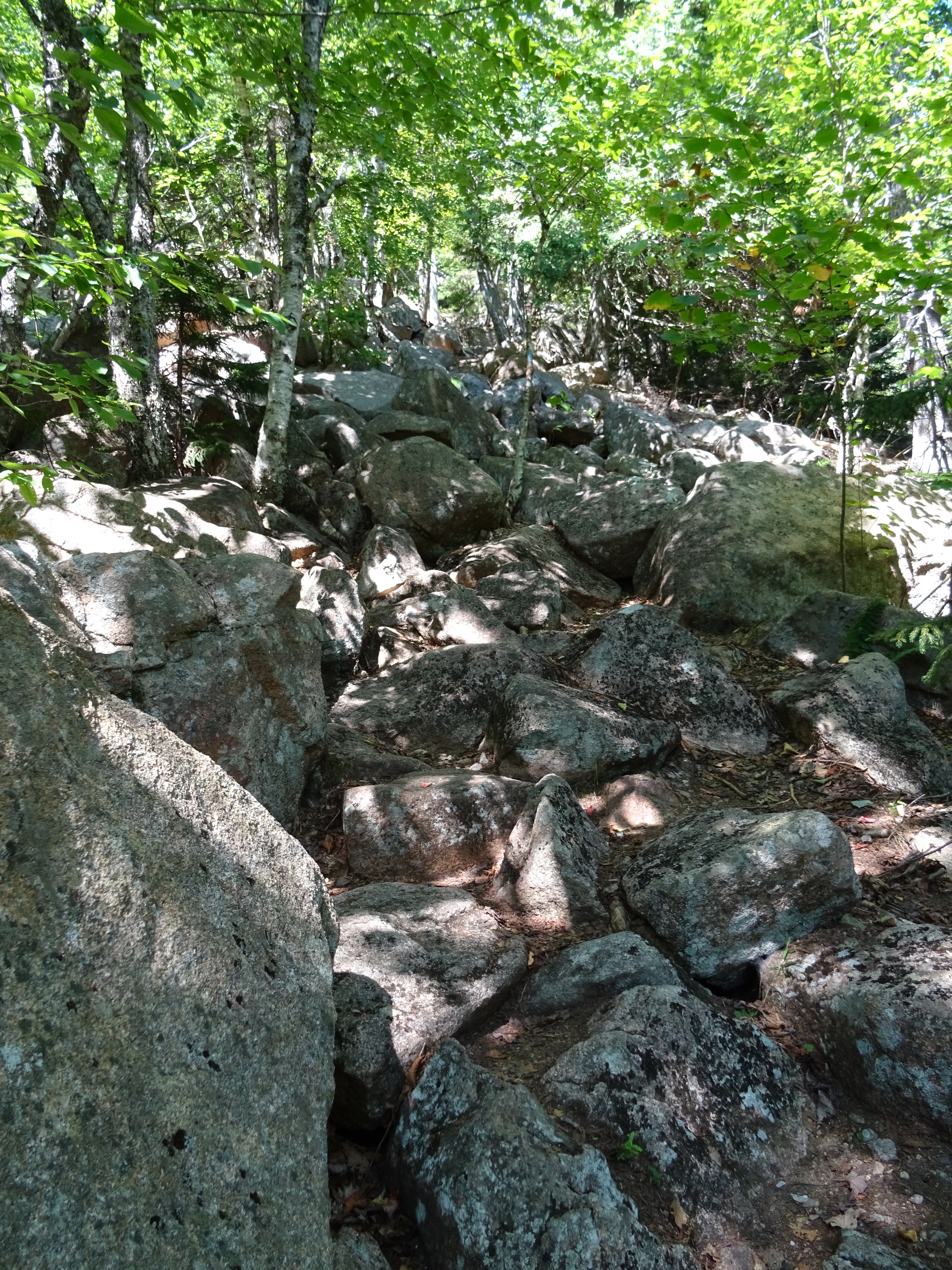
From the summit, we took the East Cliff trail down. It wasn’t an easy trail like the ones over the granite surfaces. Instead, it was rugged, rough and steep in places. It required a fair bit of scrambling over the rocks and tree roots. Whilst not difficult, it did require some concentration so as not to fall and sprain an ankle or anything. Views were minimal with only Jordan Pond occasionally becoming visible.
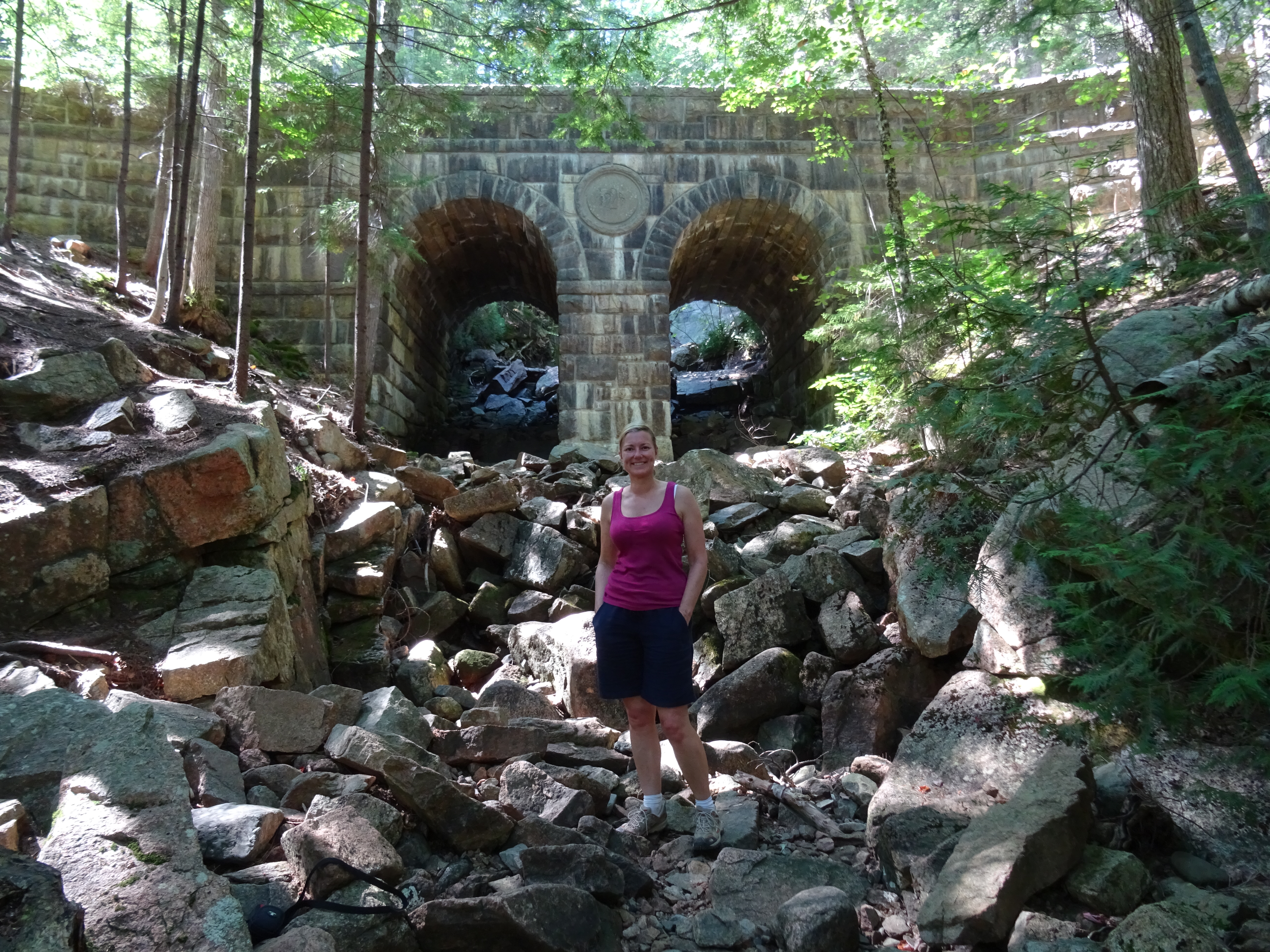
We eventually joined the Deer Brook Trail that joined us from our right. Thankfully this route was much more gentle and easier on the feet. At just around the carriage road, we came across the Deer Brook Bridge, a 140 foot long bridge which was completed in 1925. “1925” is actually carved into an oval “plinth” between the two arches.
We followed the path for a short while down to the shoreline of Jordan Pond. The distance, although we can’t be sure was around 5.4 miles.
Part Two:
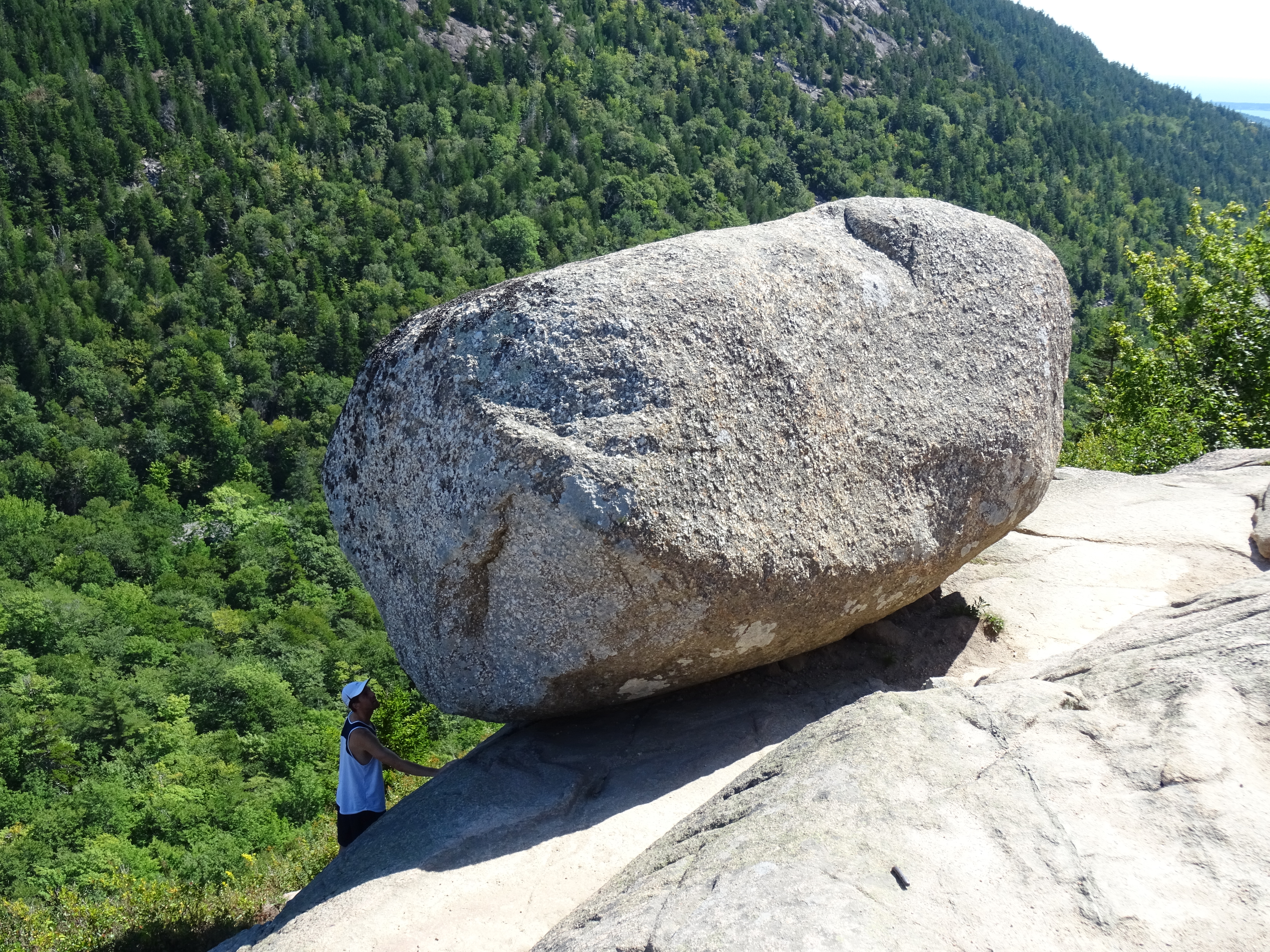
After a short break and something to eat, we headed along the coastal path to the Bubbles Divide trail which would take us up to the famous Bubbles (two small mountains overlooking Jordan Pond). The famous part of this walk and indeed in Acadia, is Bubble Rock, a large glacial erratic that hangs precariously on the eastern edge of the summit of South Bubble. Scientists believe that the rock, which was moved to this location by the glaciers originated about 40 miles away as the white granite is very different to the pink granite usually found on MDI.
The trail isn’t too bad at first but it soon becomes much steeper with steps just before the Bubbles Trail junction which heads off right to North Bubble. We didn’t find the path particularly clear to North Bubble (nor did another couple) as we ended up going “off piste” and having to make our own way up to the top through the various trees and shrubs. We didn’t see the other couple at the top or on our way down so we’re not sure if they actually made it or not. We re-joined the Bubbles Divide trail for a short distance before picking up the Bubbles Trail to South Bubble.
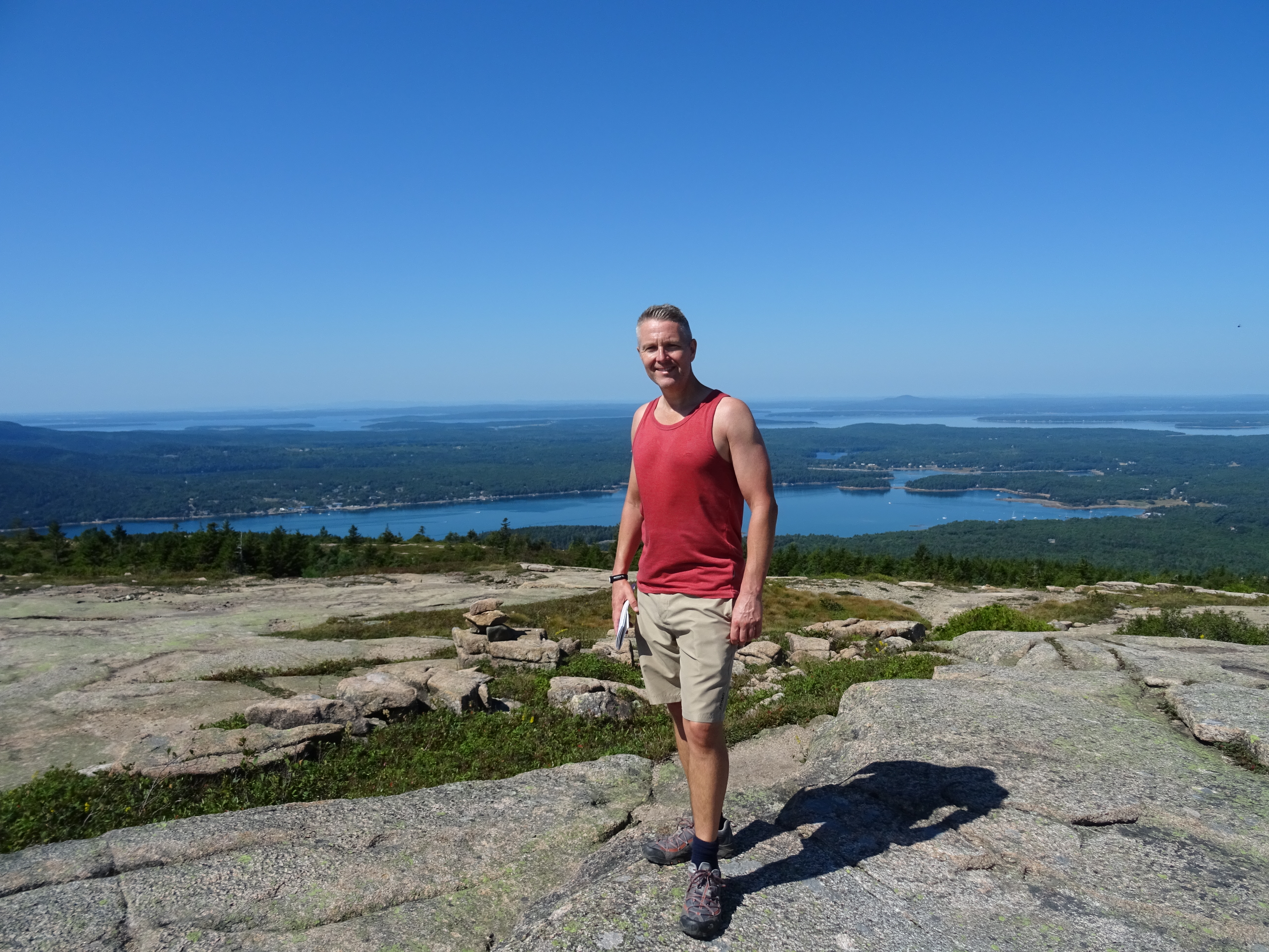
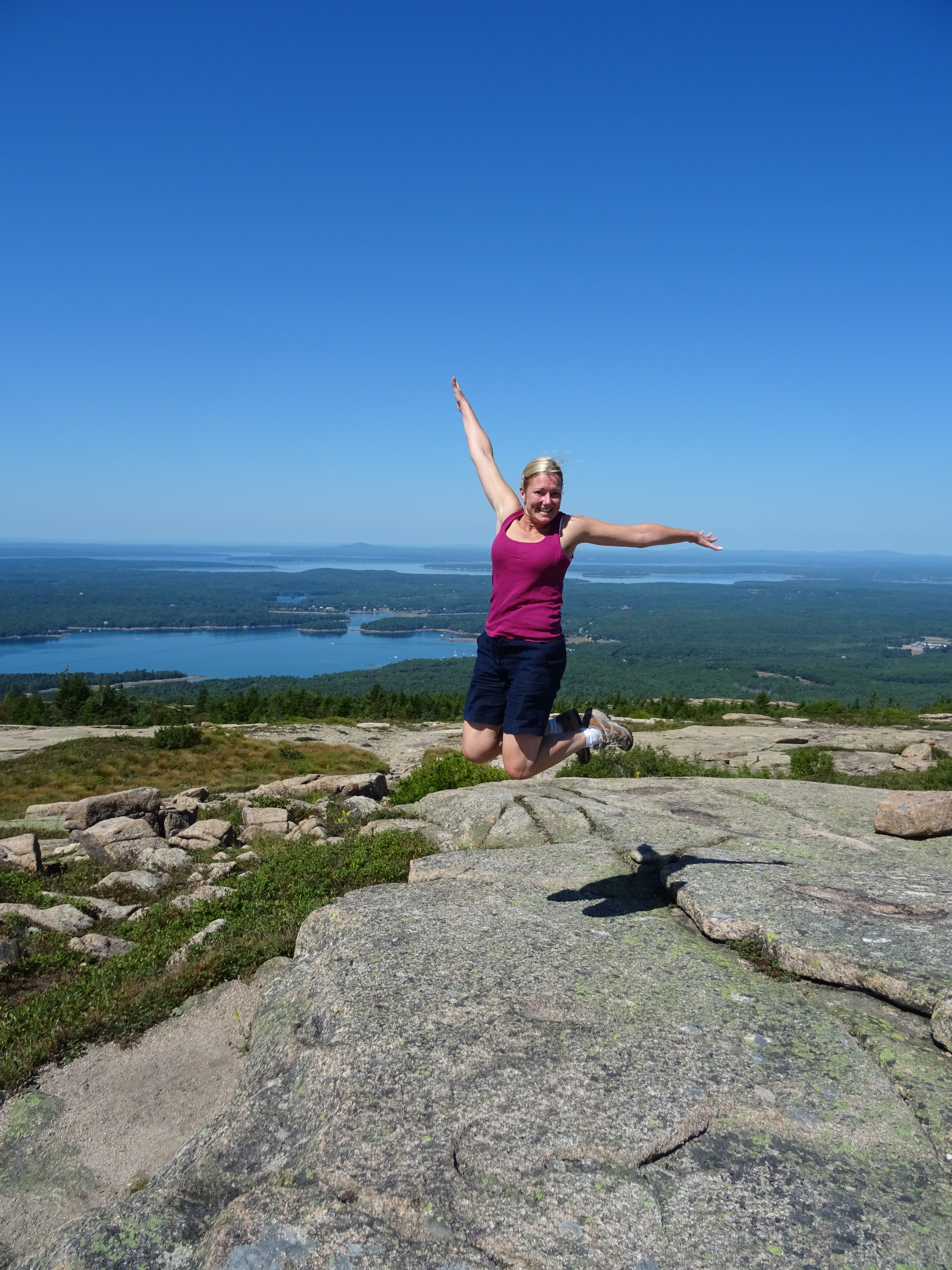
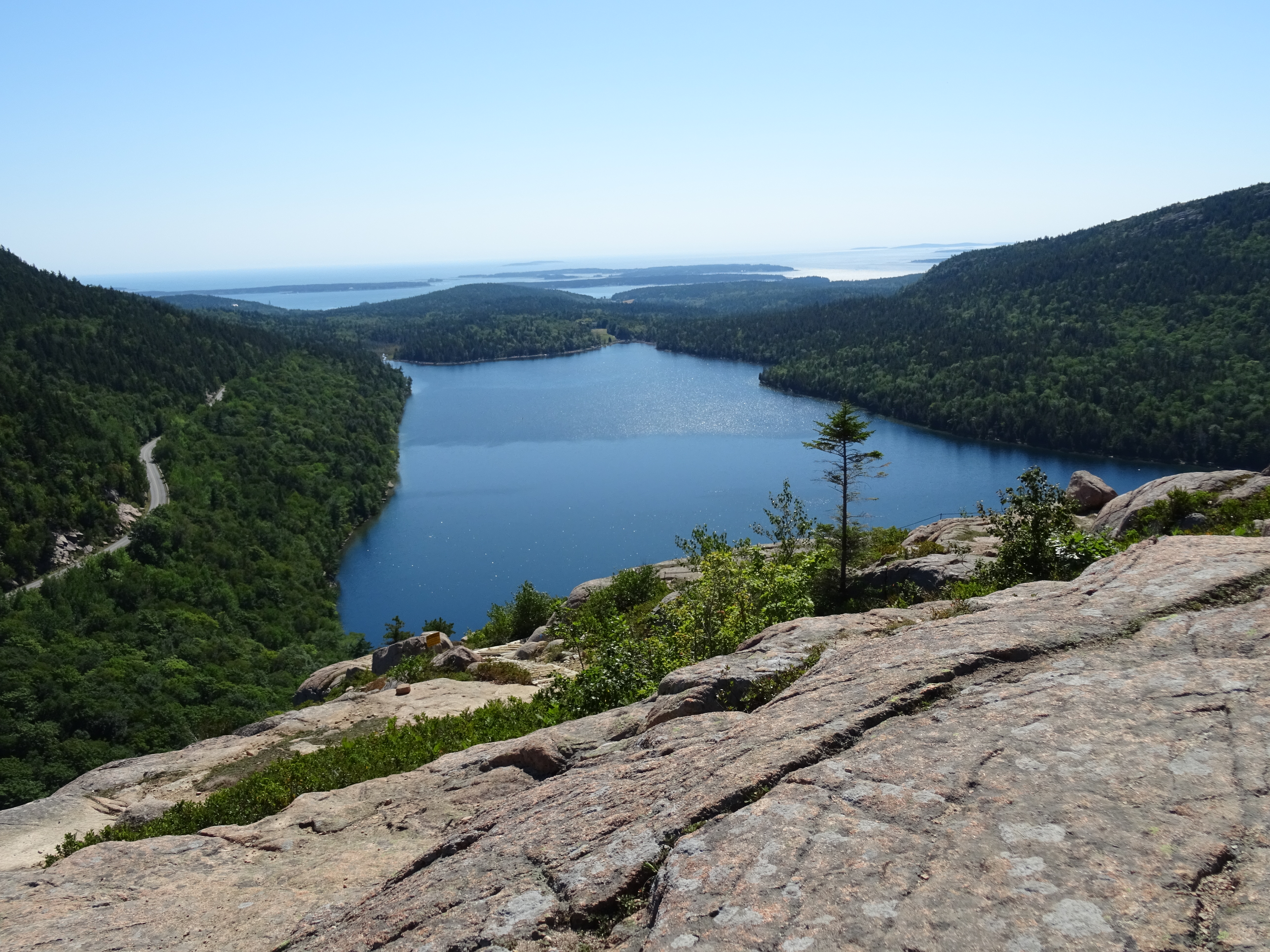
It was clear that South Bubble was a popular route as we encountered loads more people. In some spots we found it frustrating as we were “held up” by people walking more slowly. The path was very well marked as we headed up towards the rock and summit. We took the “required” photo’s, admired the views of Jordan Pond, Pemetic and Sargent Mountains and the Cranberry Islands after which we started our descent southwards to Jordan Pond.
This way down is STEEP and I mean very STEEP. In fact, it’s almost vertical in some places and looks as though you’re literally at the edge with no way down. It’s exposed and requires quite a bit of scrambling and squeezing through tight spaces. It would have been far easier going up than coming down that’s for sure. There was one particular place where Tim had to actually place my foot onto a rock ledge whilst I was coming down as I couldn’t look down. This descent was extremely tough going!
Whilst it certainly seemed as though it was taking forever as high levels of concentration were required, it probably actually didn’t and we were down at the bottom before we knew it…… thankfully, safely! This was a short hike at around 2.2 miles
At the bottom, we followed the Jordan Pond Carry path around the east side of South Bubble to join the intersection with the Pemetic NW trail.
Part Three:
Tim wanted to do Pemetic but for one main reason, I didn’t. We’d got it into our heads (wrongly) that Pemetic was the most challenging hiking trail with an exposed and almost vertical 1000 foot climb. After having already done quite a bit of hiking and also because it was boiling hot, I didn’t think that my jelly legs would take it.
After Tim had actually climbed it and we’d done a bit more research back at base, we discovered that it was the Precipice trail that was the dodgy trail not Pemetic. Oh great, I could have done it after all. Never mind!
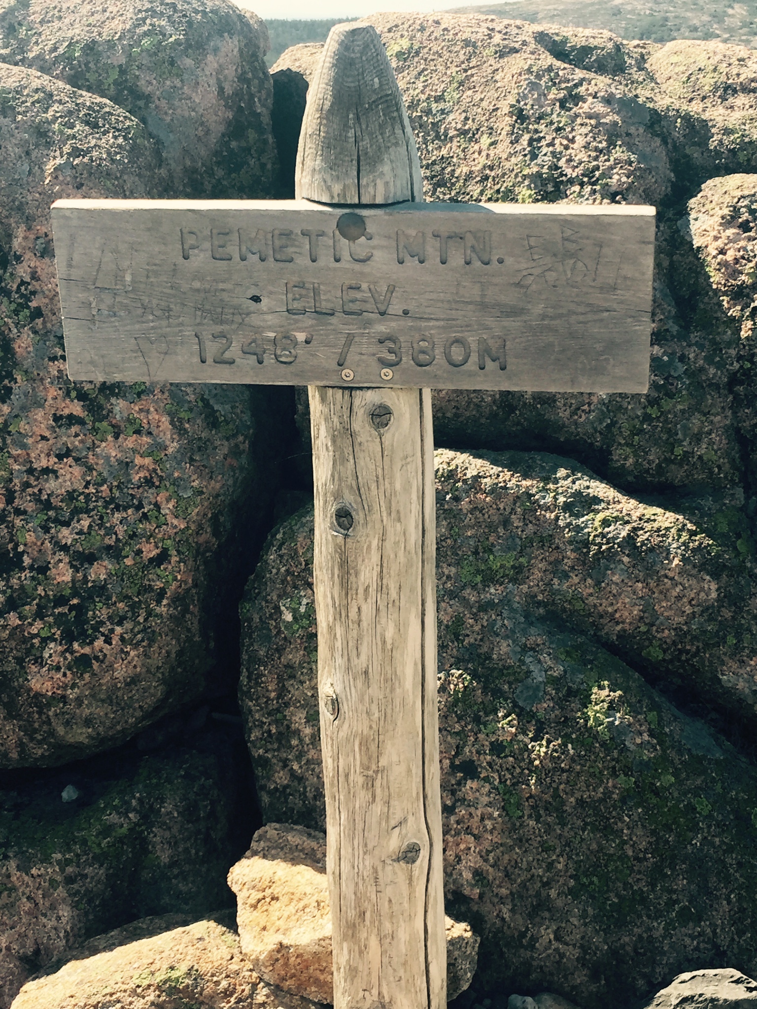
So, as Tim made his way up to Pemetic (4th highest in Acadia at 1248 feet), I on the other hand, made my way down the Jordan Pond Carry trail to the carriage road (with a little diversion to the shores of Eagle Lake) eventually arriving at the bus stop at Bubble Pond. From here, I started to make my way up the Pemetic North Ridge trail to meet Tim. It wasn’t actually long before I met him and we walked the last section together.
For both Tim’s and my separate walks, these were about 1.6 miles each therefore taking our daily total to 9.2 miles.

1 thought on “New England (Acadia NP) – Penobscot, Sargent, The Bubbles & Pemetic”